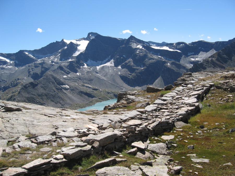

Landscape protection and material culture of the Park valleys are among the institutional aims of the protected area. Investigating traditional patterns, ancient knowledge as well as safeguarding the identity of communities, is paramount to effectively manage the transformations of the built environment as well as enhance and preserve the historical heritage.
Landscape perception is shaped by a number of heritage objects and testimonies characterizing the Val d'Aosta and Canavese valleys of the Park. The purpose of two recent works is to learn more about them, to counter the neglect and de-contextualization triggered by a poor perception of the relevance of a network of common landscape heritage.
"Landscape" means a specific part of the territory, as perceived by people, the character of which derive from natural and / or human factors and their interrelations.
European Landscape Convention, Florence, 20 October 2000 (Chapter 1, Art. 1 letter a)
Landscape is defined as a homogeneous part of the territory the characters of which are derived from nature, human history or their mutual interrelationships.
Code of cultural heritage and landscape, January 2004 (Art. 131, paragraph 1)
Handbook for the recovery and development of the rural environmental heritage of the Canavese Valleys GAL Network
The Handbook for the recovery and development of the rural environmental heritage of the Canavese Valleys GAL Network stems from a Study aimed at identifying the natural heritage sites of outstanding interest characterising the identity of a specific area, drawn up by the Working Group with the participation of architects Elio Tompetrini and Patrizia Vaschetto, Park Technical and Planning Unit, Mr Claudio Cola and Mr Franco Ferrero, freelancers. The Survey was performed as part of the implementation of the Local Development Plan by the Canavese Valleys GAL Network 2007/2013, Measure 323, Action 3, Action 2a (The aim of the survey is a list of the typical heritage elements characterising the rural landscape).
The Handbook consists of Guidelines, Description Sheets with the admissible actions for each type of object identified and analyzed, and a wide selection of photographs illustrating the various and sites of the study.
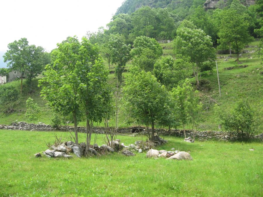
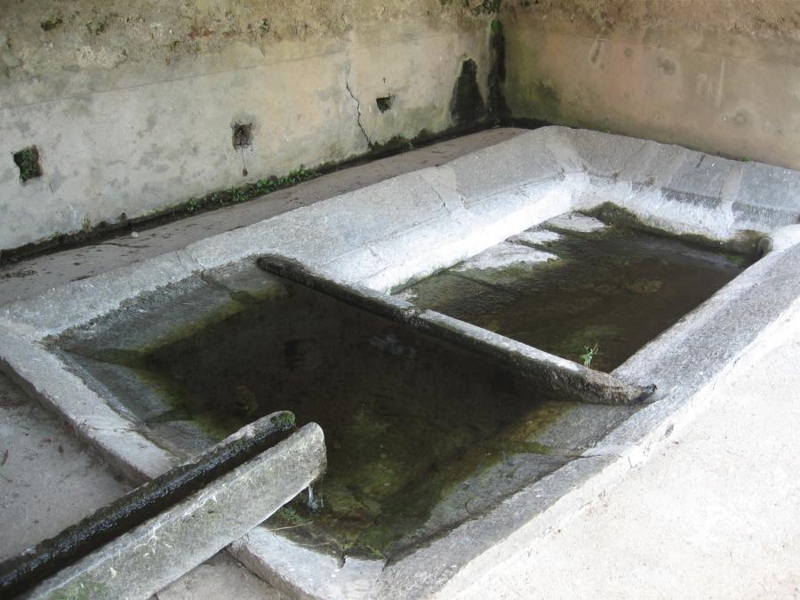
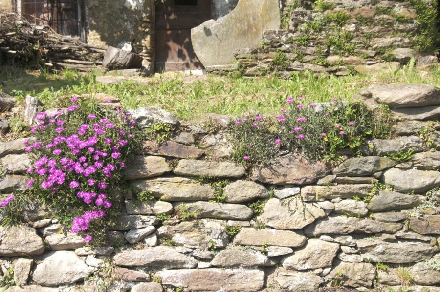
The region covered by the GAL (Local Action Network) of the Canavese Valleys features a common heritage of minor architectural artifacts such as pedestrian walkways, fences, stone walls, ditches and agricultural works, fountains and water troughs, testifying the local history and preserving the historical memory of living and working patterns.
Many of these artifacts have lost their original function and are in a state of deterioration; sometimes they are no longer integrated in the context or in the public space that required them or their materials and construction techniques have been replaced.
In other cases, thanks to the commitment of Municipalities, Mountain Communities and local associations, interesting recovery and protection actions have been put in place.
The investigations and data collected through the questionnaires filled out by the municipalities highlighted the typical and mostly recurring features of the rural landscape revealing similar construction materials (stone and wood) albeit diversified in their shapes and construction solutions.
In addition to the characterization of the settlement, these features contribute to the definition of the environmental context and help identify the interrelations between the individual objects of the region.
Even if they are considered part of the "minor" rural landscape heritage, they do contribute to defining visual relationships, to preserving information about the lifestyle and work of a not too remote past and enhance the harmony of the landscape. Sometimes they are deteriorated because of poor maintenance or because engulfed by more alienated and heterogeneous environments. This has a widespread impact on the overall quality of the landscape. A case in point are the aerial cables, utility poles and telephone installations in outstanding areas and historical centres.
Renewed attention to these sites together with the implementation of recovery initiatives go beyond the enhancement of individual heritage elements and become the starting point to redevelop the entire context.
Tourism, especially cultural tourism, draws valuable benefits from the improvement of the landscape, provided that careful maintenance and recovery actions are taken and the aim of positive impacts on a larger scale is pursued.
An excellent working method is to tackle each element or object, however simple or small, with a holistic approach, thinking of the potential impact on the overall landscape and with the aim of recovering, with the professional contribution and responsibility of the project, the harmony of degraded areas, to make them pleasant to live and visit again.
If you examine the artifact without separating it from its surrounding area, it is easier to find the appropriate and relevant solution to the whole. There are two key rules: drawing inspiration from time-proven construction methods and respecting the environment and its main features.
This is also a widely applied approach in other contexts, with the landscape no longer considered an object of mere aesthetic contemplation but one of the main engines of economic redevelopment of the region. The Handbook guidelines present the good practices for the region, analyse the causes of degradation and the need for maintenance, as well as the importance of recovering the artifacts to preserve the diverse knowledge underlying them.
Here is a list of the main types analysed:
• pedestrian historical road system with its components:
- foundations;
- stone walls;
- consolidation of slopes;
- rainwater control works;
- crossings of streams;
- particularly valuable heritage elements along the paths;
• specific features of the old rural landscape:
- historical terraces
- fences of properties, gardens and orchards,
- stone paving of courtyards, roads or squares;
- Fountains and troughs;
- channels, irrigation ditches and intake structures;
• heritage items in the agricultural landscape affecting the preservation of biodiversity: - hedges; - piles of stones;
- riparian vegetation
- trees or isolated tree groups;
- Woods and shrubberies.
Ancillary artifacts were added to the exising rural landscape, i.e. road support works, guard rails, river bank works, each affecting the perception of the landscape, intended as a set of strongly related elements.
Each element was analysed in a description sheet with the possible actions to be taken:
• description of the item including its relation with the surrounding area;
• specific features relevant to the quality of the landscaping context
• possible types of actions (preservation- maintenance- restoration - reconstruction); - Operating guidelines;
• existing examples of suitable interventions;
• existing examples of non suitable recovery interventions.
Recovery and enhancement intervention methodologies for the target heritage elements were identified to provide actionable information for both material selection and working techniques. Special attention was paid to the use of environmental bioengineering techniques and intervention methods respecting the natural heritage of the area.
Identification and detection of minor heritage of the rural landscape in the Val d'Aosta valleys of the national Gran Paradiso Park.
Between October 2015 and spring 2016, a survey was carried out in the area of the Park belonging to the Val d'Aosta region, Identification and description of minor heritage of the rural landscape in the Val d'Aosta valleys of the National Gran Paradiso Park, written by architect landscaper Rayna Dimitrova Harizanova, under the supervision of architect Elio Tompetrini, National Gran Paradiso Park.
The survey aimed at identifying and descibing the minor heritage of the rural landscape in the area of the Park belonging to the Val d'Aosta region, was carried out in the framework of the M.I.C.Ro P.A.R.Co project – Investigation method for the Preservation and Recovery of the rural and built environmental Heritage, rural and built: a six-month experience work project conducted at the Aosta headquarters of the National Gran Paradiso Park.
The starting point of M.I.C.Ro P.A.R.Co is the "Handbook for the recovery and development of environmental and rural heritage of the Canavese Valleys GAL network”. The paper aims to extend the survey to the Val d'Aosta side of the park, with its three valleys - Valle di Cogne, Valsavarenche and Rhêmes Valley – with the related municipalities, thus returning a complete and updated picture of the park and neighbouring areas. Object of the investigation is the so-called "minor heritage", as defined by the Handbook because of the small size of the elements but also of the lesser importance attributed to them by environmental protection legislation.They are minute man-made and natural elements, historically linked to human settlements, such as dry walls, paths, fences, and hedges in harmony with the landscape.
The objective of the project is to structure a method of interpretation and description of the "minor heritage" through a systemic critical survey of it in the three valleys of the Val d'Aosta side of the Park. The survey consists of four stages of investigation along with some brief guidelines for future developments of the project.
The first phase was devoted to bibliographical and cartographic documentation. Each consulted text was summed up in sheets and are an integral part of the final documentation of the project. Cartography, such as spatial plans, cadastral maps, orthophotos, existing censuses (of particular importance and quality the census carried out by the Regional Rural Architecture Office), equated to an appropriate scale and, if necessary, redesigned, form the basis for the mapping of identified heritage elements and the drawing up of description sheets.
The second step was a sharing process made of questionnaires and interviews to both professional local stakeholders such as mayors, architects, engineers, authors, scholars, farmers, and to the inhabitants. The help of the local community is critical especially for "minor heritage", where the survey is linked to material traces and not to identifiable mappable cultural factors. The aim is to produce a comparable analysis and a database available on-line at the disposal of the Authorities, the individual owners and users of the Park. It should be accessible, especially to the local population, since it is often the owners of these assets who engage themselves in their recovery.
The third phase was centred on the photographic surveys and mapping of the rural landscape under study. The survey, carried out for each village in its own agricultural surrounding, maps the exact location of each heritage element attaching photographs and indicating the orientation of the view. This step helps group the heritage into categories: minor elements characterizing the road network, the agro-pastoral areas and finally the inhabited areas.
In the last phase, the landscape heritage identified according to pre-established categories and subcategories, was reported on an interactive map associating the photo archive to the description sheets. Moreover, a quantitative survey of minor landscape heritage for each village provides statistical and graphical representations comparing villages and the valleys they belong to.
Subsequent project developments may include action proposals for cultural and sustainable tourism through a network linking the identified "minor heritage" elements, and making them accessible and useful in a culturally unified view of the traditional local landscape.