ON THE KING’S TRAILS
Virtual tour of the Gran Paradiso National Park
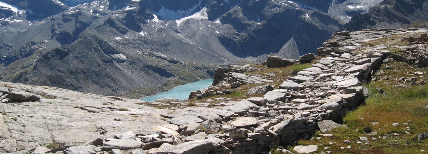
The Park is criss-crossed by a renowned and celebrated network of trails that follow the ancient royal mule tracks constructed in the second half of the 19th century by the Savoy kings. All the trails led to the hunting lodges built in the highlands to accommodate king Victor Emmanuel II on his hunting expeditions. With a view to proposing these trails to excursionists and showing them to people not yet familiar with the territory and to a wider public, the Park has produced a virtual tour comprised of three itineraries between Valsavarenche and the Orco Valley, which display on PCs and tablets, via the Internet, the wonderful natural scenery that can be admired by hiking along the ancient mule tracks.
The Gran Paradiso National Park invites you to explore it by taking a virtual walk up and down its historic mule tracks leading to the most scenic parts of the Park. The virtual visit, enriched with a number of info points, makes it possible to get to know the protected plants and animals that inhabit the Park and learn about the projects that are being implemented to preserve its territory.
If you want to experience these excursions live, consider that the mule tracks are hiking trails leading up the mountain slopes and some are quite steep; therefore it is advisable to gather information beforehand with the aid of maps and guidebooks, and select the right clothes without forgetting to check the weather forecast.
The Park on a 360-degree basis
The Gran Paradiso National Park invites you to explore it by taking a virtual walk up and down its historic mule tracks leading to the most scenic parts of the Park. The virtual visit, enriched with a number of info points, makes it possible to get to know the protected plants and animals that inhabit the Park and learn about the projects that are being implemented to preserve its territory.
If you want to experience these excursions live, consider that the mule tracks are hiking trails leading up the mountain slopes and some are quite steep; therefore it is advisable to gather information beforehand with the aid of maps and guidebooks, and select the right clothes without forgetting to check the weather forecast.
The Orco valley: Noasca – Losere lakes (Cersole Reale)
Valsavarenche: Vers-le-Bois - Plan Borgnoz
Valsavarenche: Pont – Nivolet lakes
Credits:
Coordination: Patrizia Vaschetto, Andrea Bressi - Servizio tecnico e pianificazione
Web editing and iconographic research: Andrea Virgilio, Marcella Tortorelli
Realized by Trail me up
Texts: Andrea Bressi, Laura Poggio, Patrizia Vaschetto, Andrea Virgilio, Ramona Viterbi, Caterina Ferrari, Giulia Marangoni, Rocco Tiberti
Photos: Dario De Siena, Enzo Massa Micon, Demis Massoni, Luciano Ramires, Simone Berra, Stefano Brighenti, Caterina Ferrari, Susanne Nitze, Andrea Morelli, Rainer Moriggl, Paolo Mignosa